The kid walked up while I was down in the creek fiddling around with a big rock, to tell me he’d lost his last fly. I was the fishing guide and the person responsible for that sort of thing, so I needed to act quickly. Of course, the most obvious solution would be for me to give him one. Usually, that’d be a simple thing to do– but since, in this case, I didn’t have any, it wasn’t even an option.
There must’ve been close to 100 elk filling the valley below me, and I was astounded. I didn’t want to do anything to call attention to myself, so just sat there quietly, peering at them from behind a boulder. It was pure luck that put me in that right place and at the right time because wildlife viewing wasn’t one of my goals for that day.
Tarryall Mountains,
Colorado treasure.
Smack dab in the middle of the state,
And overlooking South Park.
Improbable and majestic granite towers,
Boulders of all sizes,
Alpine tundra,
Bighorn Sheep,
And Bristlecone Pines.
Rambling streams and beaver ponds.
Smoky Quartz and Topaz.
Calypso Orchids,
Old-growth forest,
And a creek that disappears.
Tales of Utes,
The last wild buffalo,
Wolves,
Gunfights,
Walt Whitman on a train,
Homesteaders,
And miners rich with gold.
Bison Peak, McCurdy Mountain,
McCurdy Tower, and McCurdy Park.
X Rock, the Sand Creek Buttress,
Twin Eagles,
And Spruce Grove.
Humongous crystals, albino trout,
Ute Creek, and Bison Pass.
The Hourglass Burn, Lost Park Wilderness,
Brookside-McCurdy Trail,
And the Old Miner’s Cabin.
A wild place with few people,
Plenty of mystery,
And a warm wind that whispers “Tarryall.”
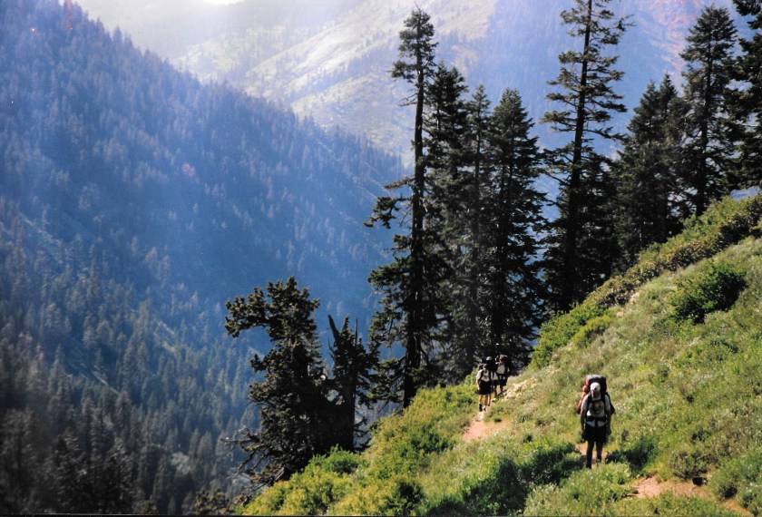
It was an early November Sunday during my slow part of the year. Autumn in Colorado’s Tarryall Mountains is spectacular. In late September, the Aspen trees turn gold, and warm sunny days are interrupted only by winter’s occasional and temporary arrival. But as fall gives way to winter, winter visits become more prolonged and more frequent. Over many years, early November is still a pleasant time to be there, weatherwise, with little to no snowpack and warm days that create almost ideal conditions for mountain biking, hiking, and climbing area peaks. But this particular year, I spent my days occupied with the aftermath of the OWA base camp lodge burning down, not with recreation. Instead of the comforts of my private lodge bedroom and bath, I was sharing an old one-room log cabin with an 18-year-old intern, Lee, and doing little besides cleanup and prep for new construction. On the day in question, I was piddling around the job site doing various chores. Since it was an off day, Lee asked if he could go on a straightforward, leisurely hike toward Bison Peak. I considered that he’d previously participated in several backcountry trips with my outdoor program. And since there was nothing for him to work on that afternoon, it seemed reasonable. And so, I gave him my blessing.
Ryan had never bonked before, at least in the metabolic shock/ overexertion sense of the word. When he started bumbling around and losing more and more of his edge, I knew that something was up and figured that’s what had happened. Not realizing what was going on, he kept on trying to mountain bike further up the Colorado Trail, although with diminishing returns. The big patches of snow that remained on the trail, even though it was June, were probably a good thing since they ultimately stopped and prevented us from riding any further. His disrupted mental and physical state likely made the retreat more palatable to the 13-year-old, since he wasn’t one to be prone to turn around before his goal was reached.
” You’re not lost if you’re happy where you are,” is a quote I altered and sometimes used. And I repeated it in my mind several times as we kept walking into the thick fog, headed toward the summit of Chiefs Head in Colorado’s Rocky Mountain National Park. I was bringing up the rear of a group of ten teenage backpackers and was typically confident about wherever Mike was leading us. But not in this instance. His assistant mountain guide, Dennis, was with me at the back of the line and kept muttering about how we were going up the wrong mountain.
The visibility was like pea soup out in that high mountain world. There were times when I couldn’t even see the front of the group. Enormous rock slabs and huge boulders looked downright puny as we kept weaving our way between one after another of them. I knew there was a magnificent alpine world of massive peaks, summer snowfields, jagged cliffs, and remote valleys surrounding us. But, for the moment, they were out of sight and out of mind.
I wouldn’t have thought about much besides how fantastic the place we were walking in was, except for Dennis’s conjectures. Even with the fog, I could see the thick clouds magically rising, falling, and then re-creating our world, and I was eager to see what each new moment had in store.
The situation probably should’ve been more disconcerting. But as I looked at the people walking ahead, I realized how well prepared they were for the conditions, no matter what happened. Everyone had solid rain gear, fleece for warmth, and warm sleeping bags. And as a group, we had sturdy tents that didn’t leak, enough food for days, and plenty of fuel for our stoves. Finally, and perhaps most importantly, we had plenty of experience. It was then that I realized that even if we were headed up toward the wrong summit, we’d be okay. We’d be fine because we were prepared, both gear-wise and mentally, for whatever might occur. At that point, I quit worrying about where we were or weren’t going. Instead, I focused on pondering the strangeness of the surroundings and relished the moment’s mystery.
Six months earlier, while sitting at my desk, I hadn’t pictured our trek along the Continental Divide in this way. While planning the trip, Mike told me it was realistically doable for a group of teenagers. And he said the route would take us through spectacular, remote high country and to the summits of several peaks, though he didn’t mince words about the trek being a bit of a grind. He knew what real outdoor adventure was and said it would undoubtedly be just that. But it wasn’t until we walked into the cloud that morning that the “real” adventure part began.
My initial thought was that the conditions were simply miserable. I couldn’t fully see more than four people in front of me, much less any distant or nearby mountains. The wet tundra had entirely soaked my boots. A persistent mist continually peppered my face, and my pack grew heavier with rainwater by the minute. To top the misery off, whenever we stopped, and I was inclined to sit down and rest, I was stymied in my thoughts to do so by the wet rocks. Putting on rain gear was out of the question since the air was too warm for that. I knew where the combination of physical exertion and non-breathable rain pants would take me, and I didn’t want to go there.
As I walked through the cloud, my prevailing thought was how it was an uncomfortable, albeit intriguing, day to be out backpacking. But the realization that we needed to get to the mythical Point B on the map had me in “suck it up” mode. Then, just as I was thinking about how things couldn’t get much more unpleasant, we stopped, and Mike huddled us all up where we could see each other. We were standing around a pile of rocks, and I could see we were on a high point of some sort. With complete confidence, he announced we’d made it to the summit of Chiefs Head. As he made his announcement, he reached into the pile, pulled out the summit register tube, opened it, and took out the signature tablet. Then, as we all congratulated each other on our efforts, he began to read the inscription dramatically, which declared that we were indeed on the summit of Mt. Alice.
“Wait,” I thought, “that’s not right.”
There was instantaneous confusion as he uttered the words. But he pointed out almost seamlessly that someone had switched the summit registers, probably as a prank. The congratulations abruptly stopped when he made the official announcement. But the resulting confusion was soon averted by his pronouncement of what probably happened. I felt the relief in the air as everyone realized we hadn’t been walking uphill for hours in the fog to little avail. So, to prove his point about the trickery, he began walking down the other side of the mountain into the fog while describing how the Chiefs Head ridge continued southward, was mellow, and easily walkable. He soon disappeared into the cloud, all the while continuing to talk.
It became eerily quiet as his voice faded away. Everyone stared into the blank spot where we’d last seen him. After a few minutes of looking at the fog and listening to the silence, I became concerned. But then he suddenly reappeared and announced that the mighty East Face of Mt. Alice was less than 100 feet to our side, and we actually were on the wrong peak.
My first instinct was to take a deep breath as I pondered the situation. But then, both Mike and Dennis each told us we’d simply follow an alternative walkable ridge that would eventually take us to our destination. And so, we all relaxed as we realized we weren’t going to have to backtrack. I knew we had everything needed to comfortably and safely get where we were going. It was further affirmation of what I’d realized earlier that day about being lost. And so, we regrouped and headed into the fog and an exciting, mysterious world.
It wasn’t the easy way out of the predicament. But we chose the more physically painful of the two options, climbed up the steep ridge, then over the saddle that led us out of Paradise Park and down into Hell Canyon.
What follows is the story of how the situation unfolded:
The group went to work busily, setting up tents and preparing our backcountry campsite. It was the theoretical end to a long day of backpacking. We were in the Colorado mountains at a remote location in Rocky Mountain National Park called Paradise Park. And before organizing my gear, I did one of the more essential things outdoor adventure guides should do before leading a group into the wilds. I took the guidebook out of my backpack and read about where we were setting up camp. There was no ambiguity in what I read: “There is no overnight camping allowed anywhere in Paradise Park.” Initially, I might have been reading it wrong, so I re-read it. But the second time around, the words were the same. And I realized that if we stayed, we’d not only be violating federal regulations but also likely be doing something environmentally detrimental. And so, I concluded we needed to move.
The teenagers were methodically getting things ready for supper and the night ahead. I couldn’t help but note how physically wasted they all looked as I yelled, “Oh, shit!” At that point, it no longer mattered that we’d backpacked and bushwhacked for 6 hours, our legs were tired, or we thought we were at our destination- because we needed to move our campsite.
Thankfully, we were only about a half-mile away from the southwestern boundary of the Park. On the topo map, I noted a pass on the ridge to our south, which we could cross to exit the National Park and enter the Indian Peaks Wilderness. More specifically, it would take us to the high mountain backcountry basin known as Hell Canyon. The place’s name didn’t sound particularly inviting. But I was pleased to know there was somewhere nearby we could move to where we could camp without causing physical harm to the area.
My scream caused the brakes to be applied to the campsite set-up operation. So, for the moment, there was a pause in the activity as everyone waited to find out what the commotion was about.
After my initial attention-getting blurt out, I said calmly, “We can’t stay here; there’s no camping allowed.”
I recognized that I should’ve figured out the camping situation before traipsing 15 miles into the backcountry with them. But I knew that worrying about it wouldn’t help rectify a situation that needed rectifying. It was 5:00 in the afternoon, and I figured we had about three more hours of daylight left and would need every bit of it to reach another suitable spot to set up tents and have a pleasant supper. And so, I accepted the reality that we had to get moving and that it needed to happen sooner rather than later.
Looking around at the various group members, I could see they were, in turn, looking out at our nearby surroundings. It was evident they were trying to figure out where the actual Paradise Park boundary lay and, thus, where we needed to go. I began explaining the situation and realized that most of the teenagers were mentally preparing themselves for something much easier than what needed to happen. Just the irritation of having to pack their stuff back up and move a few hundred yards before eating supper would be plenty painful. But little did they know…
After a few long moments of looking around, one of the group members said, “Where to?”
I didn’t say anything initially because I didn’t have the heart. But I did look up at the not-so-distant pass. Everyone turned and looked up to where my eyes were pointing, and there was a profound moment of silence as it all began to soak in.
And so, I verbalized the new plan. While pointing up toward the pass, I said, “The boundary between the National Park and the Indian Peaks Wilderness is along that ridge. There’s a pass up there between those two peaks. If we climb up and cross it, according to the topo, we can just walk down from there into a place called Hell Canyon. It looks like there are all kinds of climbing down there, some lakes, and a trail that’ll take us back pretty close to where we ultimately need to get to at the end of the trip. We ought to be able to get up and over the pass and set up camp before dark if we get moving now. So, let’s go!”
The silence continued after I finished speaking. I wanted to think it was because everyone was busy developing thoughtful, efficient personal move plans. But more than likely, it was because they were attempting to process their disbelief. I don’t think anyone was all that interested in the fishing, climbing, or backcountry options in Hell Canyon. But I do believe that some of them thought it was a cruel joke.
After a few minutes, everyone came to grips with the reality of the moment and just began re-packing. I felt terrible about the situation and was also tired. But once we were packed up and moving, I felt only their positive energy, not the lethargy and fatigue I expected. I watched as 12 ordinary people headed out toward an unknown destination, their energy coming from somewhere I couldn’t see. In an instant, each became a sort of unassuming superhuman.
With the sun creeping down in the western sky, we crossed over the pass and began the descent into a place we’d known nothing about a few hours before. Mount Hiamovi dominated the eastern sky, and Upper Stone Lake shone like a mirror to our south and a thousand feet below. A pleasant tundra-covered slope cut through massive rock outcroppings to either side. It provided straightforward access to our new world. Before we knew it, we walked out on a boulder and saw only clear sailing ahead as we transitioned from going up to going down.
It turns out that the place we went is known as one of the wildest and most spectacular places in North America. Few people get there because it’s so remote and hard to reach. I witnessed an intriguing power and wild spirit in the place and the people during that late afternoon. It suddenly became clear to me just how remarkable and capable humanity and nature are.
And to think—it wasn’t even somewhere any of us had planned to go that day.
The various names that are attached to places are intriguing. Some are obvious since they either reflect a physical characteristic or commemorate an individual of importance. But, others not quite so. Many place names tell a story in a few short words—some less straightforward than others, but each worthy of knowing. Here’s a few such stories that I’ve heard. Listen, and maybe you will, too………………..


You must be logged in to post a comment.